
Overview Who Needs This? Excerpts Order Book Pictures Chapters
Answers Reviews Destinations Free Stuff More Contact Us
Death Valley National Park
Death Valley National Park offers Badwater Basin, the lowest point in the Western Hemisphere at 282 feet below sea level. The Black Mountains are across Badwater Road from the salt flats which makes for a surreal landscape. The basin was a 30-foot lake but evaporated and left up to a five foot layer of salt behind. Walking into this evaporated lake is a treat but is not recommend in the heat of summer. A briny pond which is four times saltier than the ocean remains in the basin during the winter but shrinks to a puddle in the summer.
Another Death Valley classic is the Artist's Drive loop, which is a scenic 9-mile one-way road. Only vehicles less than 25 feet can make it through the dips and curves through ravines and rock formations. The highlight of this drive is Artist's Palette where the colors range from pink, green, purple, brown and black rock. These colors were formed during explosive volcanic times. The best time to see the brilliant colors is during the evening when the sun is setting.
Death Valley is the largest park in the contiguous U.S. comprising of more than 3.3 million acres of desert wilderness for backcountry camping and hiking. Peak visitor season is through the winter and spring months. Death Valley has more than 785 miles of roads including hundreds of miles suitable for mountain biking.
Park highlights are Eureka Dunes, Scotty's Castle, Ubehebe Crater, The Racetrack, and Titus Canyon in the northern part of the park.
In the central part near Stovepipe Wells there are the Sand Dunes, Mosaic Canyon, Salt Creek, and near Furnace Creek Visitor Center there is Golden Canyon, Zabriskie Point, Artist's Drive, Devil's Golf Course, Natural Bridge, Badwater Basin, and Dante View. In the western section of Panamint Springs highlights include Lee Flat Joshua Trees, Father Crowley Point, and the Charcoal Kilns.
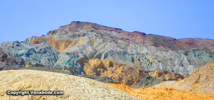
Above: Picture of pastel colored mountains in Death Valley. The colors in this national park are vast, everything from pony brown to pretty in pink. Because Death Valley is the driest place in the states which means there are well over 325 days a year of cloudless blue skies.
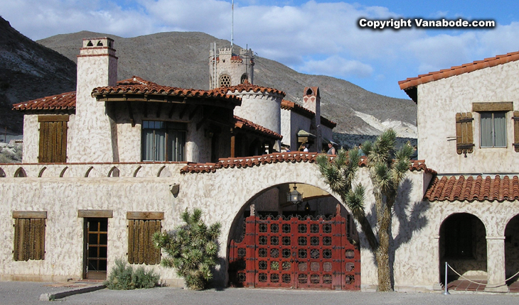
Above: Picture of Scotty's Castle. You are free to walk through on your own and behind the castle is a trail leading to the hills.
Coyotes are one of the many wild animals you might see while on vacation at Death Valley National Park, along with bighorn sheep, rattlesnakes, kangaroo rat, chuckwalla and scorpions. Mosaic Canyon hike is up a narrow, polished marble-walled canyon. Some slickrock scrambling is necessary early in the hike. These mosaics are fragments of rocks that have been naturally cemented together. The total distance of the Mosaic Canyon hike is less than three miles.
If you are going to visit the Sand Dunes then you have to take time to walk through Mosaic Canyon. Scotty's Castle is a 55 mile drive from Furnace Creek but it is a nice drive through the national park and you never know what kind of wildlife you might encounter. A quick tour in your car around Twenty Mule Team Canyon just south of Furnace Creek Visitor Center is a great way to see more of the park without having to hike too far or risk a flat tire on the many high-clearance backcountry roads within the park.
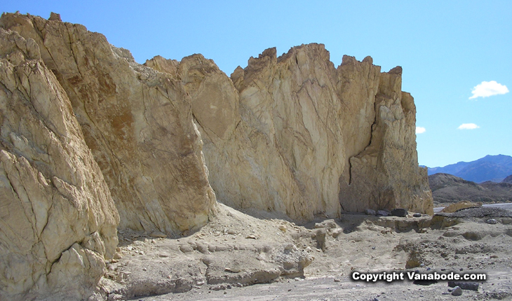
Above: Picture of rock formations while driving one of the loop trails off the main highway through Death Valley.
We did hike the beautiful Golden Canyon Trail to Red Cathedral and Manly Beacon on through to Gower Gulch Loop. Grab a trail guide on the Golden Canyon/Gower Gulch hike because there are other trails that connect such as the 2.5 mile addition to Zabriskie Point. This trail twists through narrows, colorful rock formations, climbing to views of the badlands, down through a dry wash with old borax mines, ending with optional rock scrambling around a 25-foot drop-off, and back to the parking along the base of the hills.
Jason's thoughts - Golden Canyon/Gower Gulch Loop trail provided us with some nIce simple easy hiking with almost complete privacy. Remember folks the earlier you go and the further you go the less people you will see. The colors were nearly as impressive as the canyon walls of Zion, but without the crowds they were especially fun to walk through.
Kelly's thoughts - I totally loved hiking the Golden Canyon/Gower Gulch Loop trail. We started at 6 a.m. so the temperature was perfect for the climb to Manly Beacon as well as seeing the sun rise over the valley. I did not know that Mosaic Canyon was full of marble. I couldn't believe how beautiful, soft, and cool it was, oh yea, extremely slippery too.
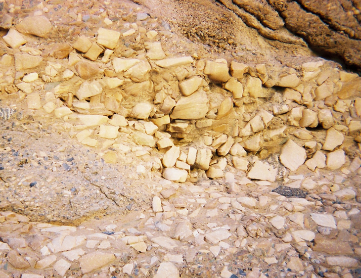
Above: Picture taken while hiking through Mosaic Canyon.
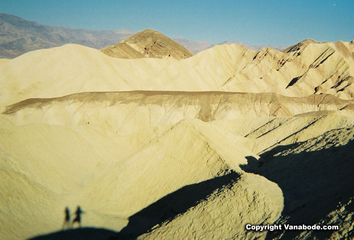
Above: Unretouched shadow picture taken early one morning while hiking Golden Canyon.
Click for the Sand Dunes, Zabriskie Point,
and Salt Creek
Click for info on the wildflowers
of Death Valley
Click for backcountry camping, driving,
and hiking
Information on RV camping in Death
Valley


Home
Contact Us Copyright
© 2007-2016 Free
Guide They Hate Me
Privacy
Policy Terms
and Conditions Media
Press Affiliate